

Beinn Liath Mhor a' Ghiubhais Li [Beinn Liath Mhor a' Ghiuthais]
Good walks are even better shared.
NH2771 : Leaving the summit plateau of Beinn Liath Mhor a'Ghiubhais Li
bill copland Photo source
Overview
Beinn Liath Mhor a' Ghiubhais Li
Introduction
Beinn Liath Mhor a' Ghiubhais Li is a gem nestled in the heart of the Scottish Highlands, standing proud at 1025 meters. Its stature as a Munro ensures that it garners the attention of both seasoned climbers and casual hikers looking to stretch their legs in stunning scenery.
Geology
The mountain’s geology is predominantly composed of schists and gneisses, showcasing the rugged beauty forged by millennia of geological activity. Hikers can appreciate the intricate formations and erosion patterns that tell stories of Earth's history. Keep your eyes peeled for unique rock formations along the trails!
Routes
Two popular routes cater to different hiking styles. The Swift Route from Glen Carron is a favourite for those seeking a moderate challenge. Meanwhile, the Circuit via Beinn Liath Mhor South Top offers a rewarding day out for adventurous souls looking to scale two summits in one trek.
Summit Features
Upon reaching the summit, expect to be greeted by a small, well-formed cairn – the perfect backdrop for that all-important selfie! The vast views will leave you speechless, as you gaze upon the lochs and peaks of the Highlands, possibly questioning your life choices while eating a soggy sandwich.
Terrain
The terrain ranges from rocky outcrops to grassy slopes, interspersed with boggy patches. Make sure to wear sturdy boots to navigate the quirks of the Highland landscape!
Views
As you stand at the top, you’ll be treated to breathtaking panoramas, with Loch Carron and the Applecross peninsula dominating the horizon. Spring and autumn are ideal for taking in these views, with striking colours and clear skies enhancing the experience.
Hazards
Understanding the Highland weather is key; it can change faster than you can say “gourmet haggis”. Be cautious of slippery paths, especially after rain, and keep an eye on the forecast before embarking on your adventure.
Nearby Summits
Explore further by visiting nearby peaks, such as Beinn Liath Mhor South Top and Sgurr nan Ceathreamhnan. Each offers unique views and trails that will delight any outdoor enthusiast.
Access
For the best access, park at NH275727 in Glen Carron and lace up your boots. Public transport options are available via bus and train, but do check schedules, as they tend to be as elusive as the Highland mist.
Facilities
While wandering the hills, remember that facilities are scarce on the mountain, but the nearby village of Achnasheen offers a café and a pub - an essential stop for a well-deserved recovery pint!
History
The mountain’s name, translating to 'The Great Grey Mountain', reflects its impressive countenance. Steeped in history and local lore, Beinn Liath Mhor is a testament to the enduring landscapes shaped by the clans of old.
Conclusion
Whether you’re a Munro bagging aficionado or just after a pleasant walk, Beinn Liath Mhor a' Ghiubhais Li will not fail to impress. Pack your good sense of humour along with your essentials, and enjoy the adventure!
Explore routes near Beinn Liath Mhor a' Ghiubhais Li [Beinn Liath Mhor a' Ghiuthais]
Walks starting near this hill. Open a route to check its map, distance and full itinerary.
Beinn Eighe Lancaster Wreckage at Coire Mhic Fhearchair
View route
Glen Affric: Coire Loch Woodland Trail
View route
Loch Migdale from Torroy: Spinningdale pinewood and loch shore walk
View route
Fairy Lochs Liberator Wreckage Circuit
View route
Route planning notes
These notes describe possible approaches. Check a route's map and access information when planning your walk.
Swift Route from Glen Carron
Starting from the scenic Glen Carron, this route provides a well-worn path that winds through heather and grasslands before ascending steeply to the summit.
Circuit via Beinn Liath Mhor South Top
A longer circuit that not only takes you to Beinn Liath Mhor but also includes a visit to the South Top for stunning views across the landscape.
Make a day of it, together
Find someone to share the walk with, or organise a day out along a route you like.
Photo Gallery
View all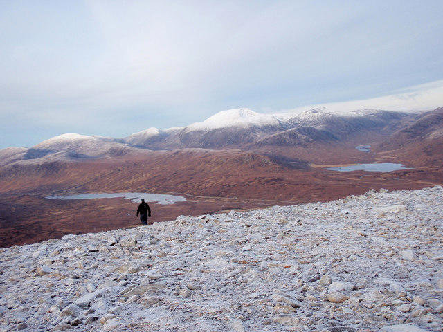 Photo could not load
NH2771 : Leaving the summit plateau of Beinn Liath Mhor a'Ghiubhais Li
bill copland
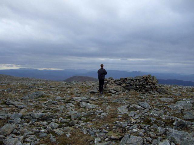 Photo could not load
NH2871 : Summit of Beinn Liath Mhor a' Ghiubhais Li
Chris Upson
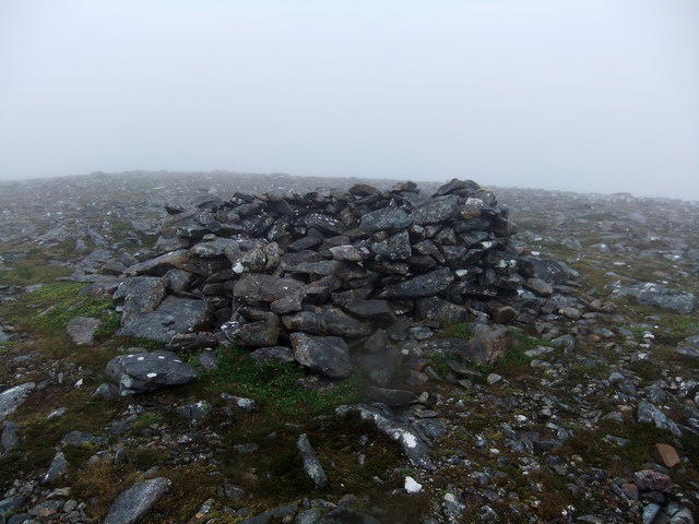 Photo could not load
NH2871 : Summit shelter, Beinn Liath Mhòr a' Ghiubhais Lì
David Brown
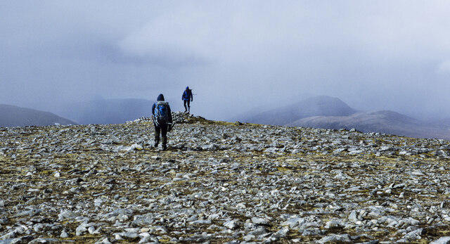 Photo could not load
NH2871 : Crossing the summit of Beinn Liath Mhòr a' Ghiubhais Lì
Trevor Littlewood
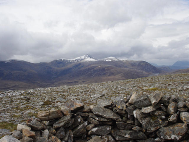 Photo could not load
NH2871 : The summit of Beinn Liathach Mhòr a' Ghiubhais Lì
Jonathan Venn
Hill facts and local notes
Classifications
Elevation
766m
2,513 ft
Prominence
281m
Coordinates
57.6987, -4.8864
NH280713
OS Map
20
Explorer: 436S
At the Summit
The summit is marked by a small cairn and offers dramatic views over the Highlands, with the sprawling lochs visible in the distance. You might even spot a fellow hiker's lunch if you're lucky.
Terrain & Geology
The mountain is primarily composed of metamorphic rocks, featuring schists and gneisses typical of the Scottish Highlands. The interesting geological formations and erosion patterns offer a glimpse into Scotland's ancient past.
Views & Scenery
From the summit, hikers can enjoy panoramic views of the surrounding peaks, including the impressive Loch Carron and the mass of the Applecross peninsula. On a clear day, you may even catch a glimpse of Skye!
History & Heritage
Name Origin
The name 'Beinn Liath Mhor' translates to 'The Great Grey Mountain,' a fitting description for its rugged and appealing landscape.
Historical Significance
The mountain is part of the local heritage of the Scottish Highlands, with longstanding cultural connections to the clans that have inhabited the region.
Getting There & Facilities
Parking
There's a convenient parking area at NH275727 in Glen Carron, which serves as a great starting point for various routes.
Public Transport
The nearest train station is in Achnasheen, from where local buses serve the Glen Carron area, but check schedules as they can be sparse.
Nearby Facilities
While there are no facilities directly on the mountain, the village of Achnasheen offers a café and a pub, perfect for a well-earned rest after a hike.
Safety Information
Known Hazards
- Beware of changing weather conditions, as they can turn on a dime. The terrain can be slippery after rains, especially in boggy areas.
General Safety Tips
- Check weather conditions before setting out
- Carry appropriate clothing and equipment
- Let someone know your planned route
- Take a map, compass, and GPS device
- Carry emergency supplies: food, water, first aid kit, torch
Hills
Some common questions about the hills answered
Are there group walks up Beinn Liath Mhor a' Ghiubhais Li [Beinn Liath Mhor a' Ghiuthais]?
Many walkers use Walkmates to join or organise walks with others. You can check for group walks around Beinn Liath Mhor a' Ghiubhais Li [Beinn Liath Mhor a' Ghiuthais] through the maps
Are there other walkers around Beinn Liath Mhor a' Ghiubhais Li [Beinn Liath Mhor a' Ghiuthais]?
Activity varies by location and time, but Walkmates lets you see whether others have shared walks or shown interest in this area. Find other people through the walking friends search walking friends for Beinn Liath Mhor a' Ghiubhais Li [Beinn Liath Mhor a' Ghiuthais] search or of course create your own walk for Beinn Liath Mhor a' Ghiubhais Li [Beinn Liath Mhor a' Ghiuthais]
Can I organise a walk to Beinn Liath Mhor a' Ghiubhais Li [Beinn Liath Mhor a' Ghiuthais]?
Yes. If there aren’t any walks listed already, you can create a walk and make it available for others to join.
If you're signed up to Walkmates, you can create a walk to Beinn Liath Mhor a' Ghiubhais Li [Beinn Liath Mhor a' Ghiuthais].
How do I find a walk up this hill?
There are often multiple ways to walk this hill, depending on experience and route preference. Walkmates helps you explore walks and routes that others have shared.
Can I suggest a new route up Beinn Liath Mhor a' Ghiubhais Li [Beinn Liath Mhor a' Ghiuthais]?
Yes. You can suggest or create routes to share with others. Walkmates focuses on the social side of walking, so routes are used to help people organise walks and explore areas together, rather than as detailed navigation tools or route libraries.
Other uses really appreciate knowledgeable walkers sharing their routes. Share your favourite route to Beinn Liath Mhor a' Ghiubhais Li [Beinn Liath Mhor a' Ghiuthais] here
The is an error or something incorrect about this hill. How do I let you know?
We always strive to keep the information on Walkmates as accurate as possible. If you find an error, please let us know through the contact form and we'll aim to correct it as quickly as possible
Community Discussion
Comments
Location
![Beinn Liath Mhor a' Ghiubhais Li [Beinn Liath Mhor a' Ghiuthais] location map](https://cdn.walkmates.com/hill-maps/hill-sources/1054/57.69866_-4.88638.png)
Grid reference: NH280713
View on OpenStreetMapOpens a map in a new tab, centred on the hill.
No comments yet. Be the first.